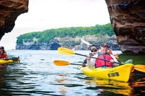

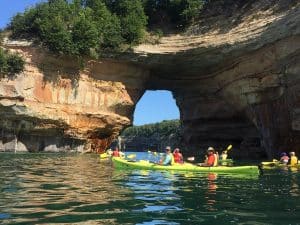


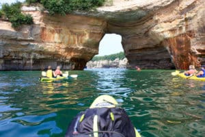
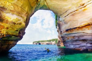
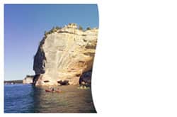


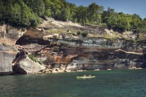
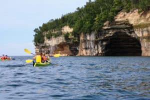

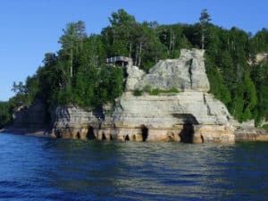
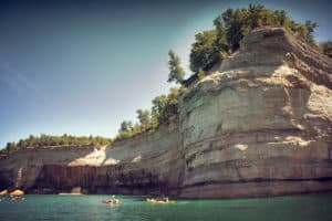
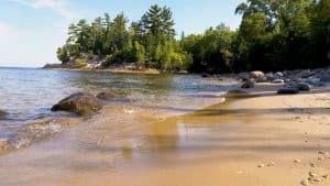
When you visit Munising and plan a Paddling Michigan adventure, you get up close and personal with the amazing rock formations that have formed along the shoreline. These geologic formations aren’t accessible by land – that’s one of the many reasons to consider a kayaking trip; you can enjoy the full experience and beauty of the area. Walking the shoreline just won’t offer the same fantastic views.
During a Paddling Michigan trip, you get to see natural wonders unique to Upper Michigan. These geological phenomena are created by the lake, and it takes a trip on the lake to truly see them in all their glory.

What You See During a Paddling Michigan Excursion
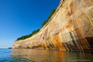
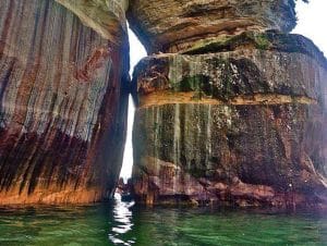
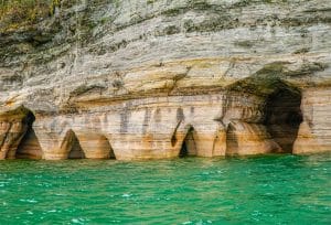
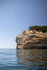
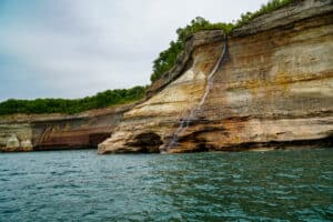
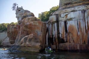
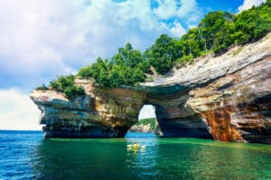
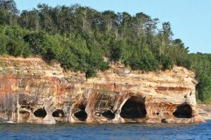
The most magnificent of these geologic formations are the 50-200-foot sandstone cliffs that extend over 15 miles of the Pictured Rocks National Lakeshore. The unceasing waves of Lake Superior have created turrets, stone spires, blowholes, sea caves, and arches over the centuries. These nature-made structures are amazing, especially when you see the gorgeous colors from the mineral stain that decorate the cliffs. It’s from these colors that Pictured Rocks gets its name. Some colors you can expect to see are from minerals original to the region, including:
- Iron that creates red and orange shades
- Manganese that reveals black and brown colors
- Copper that creates blue and green tones
- Limonite that offers white and tan colors

Expect variations and differing hues of these colors depending on the sunlight, the time of year, and the depth of the water.
The Creation of Painted Rocks
When groundwater oozes from the cracks in the rocks and trickles into the rock’s face, these stunning colors emerge. In fact, the rocks were so breathtaking that some of the sandstone was quarried from nearby Grand Island to create buildings during the late 19th century. Harder sandstone exists in the area, too, and it’s that sandstone that causes some of Munising’s beautiful waterfalls.
The park’s sandstone came from quartz sand and gravel deposits that were shed from a regional mountain range in the north.
How Old Is Pictured Rocks?
Geologists date the sedimentary rocks and deposits that create the beauty of Pictured Rocks into two wide segments of geologic time, each covering millions of years. They are:
- The Late Precambrian, Cambrian, and Early Ordovician Periods, covers 500-800 million years before present time. During this period, the sediments became deposited in the shallows and deltas of Northern Michigan’s waters. These sediment deposits transformed over centuries into the sandstone layers you can see from the lakeshore. With the exceptions of these layers, an ancient glacial drift covers the rest.
- The Late Quaternary Period, spans two million years before present era to now. During this period, the oldest formation, called The Jacobsville Formation, was exposed to the lakeshore,creating deep red deposits with white mottling. You can only see the top few feet of it – just what rises above the lake level along the lakeshore.

To get a closer look at these amazing geological wonders, find your sea legs and plan a Paddling Michigan adventure. With packages that include kayaking and hiking, you’ll have unique access to some of Upper Michigan’s most beautiful natural wonders.